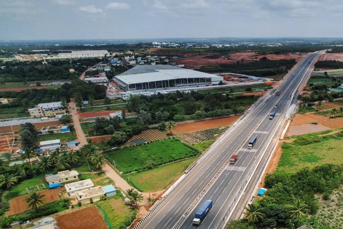
The project was first conceptualised in 2017, with work on the drawing board commencing in 2018. Groundwork began in 2020, but only 60 km has been completed so far.
The project is envisaged to ease traffic congestion in Bengaluru city by providing a bypass for freight traffic so that heavy vehicles can move along the peripheries of Bengaluru without entering it.
The construction of an elevated corridor through the Bannerghatta National Park (BNP) as part of Bengaluru Satellite Town Ring Road (STRR) has been approved by the state wildlife board, chaired by Karnataka Chief Minister Siddaramaiah.
However, officials from the Public Works Department (PWD) estimate that it will take at least three years to complete the STRR Project.
The National Highway Authority Of India (NHAI) is developing the 280 km Satellite Town Ring Road (STRR) will connect 12 important towns around Bengaluru including Dobbasapete, Doddaballapura, Devanahalli, Sulibele, Hoskote, Sarjapura, Attibele, Anekal, Tattekere, Kanakapura, Ramanagaram and Magadi.
The delay in the construction of STRR and the elevated corridor in BNP is expected to increase the project cost by a minimum of 10-15 per cent annually, excluding the cost of land acquisition.
Officials are concerned that financial constraints may further delay the project. A senior PWD official expressed worry that the project could face a similar fate as the Peripheral Ring Road (PRR), with only a partial stretch completed and the rest stalled due to bureaucratic obstacles and land acquisition issues.
According to PWD records, the project was first conceptualised in 2017, with work on the drawing board commencing in 2018. Groundwork began in 2020, but only 60 km has been completed so far.
The Greenfield project has seen the completion of work between Dobbaspet and Hoskote, extending to the Tamil Nadu side. However, the remaining sections have yet to be tendered.
The completion of the project is estimated to take three years, with the elevated corridor work expected to be finished in eight months. The typical timeline for a civil project, from tendering to execution and completion, is usually around 18 months.
Following the standard procedure, the proposal for the elevated corridor will now undergo scrutiny and approval by the National Wildlife Board. The dates and agenda for the next meeting are yet to be scheduled, reports The New Indian Express.
About STRR
STRR will comprise a network of both national highway and state highway corridors.
Bengaluru Satellite Town Ring Road
The project will connect six National Highways and eight State Highways, which will help reduce congestion in the city, It will alleviate traffic congestion within Bengaluru by providing an alternative route for trucks to bypass the city’s congested areas.
Though originally proposed in 2005, the STRR greenfield expressway project gained momentum after the Modi government announced that the funding and execution would be undertaken under the Bharatmala Pariyojna project. The project is expected to cost Rs 17,000 crores.
While NHAI is funding 60 per cent of the project cost, the State government of Karnataka will fund the remaining corpus (mostly the cost towards land acquisition).
STRR is being built in 3 parallel phases and involves the construction of NH-948A and the realignment of existing NH-648 (old NH-207).
To manage the development of STRR, the Karnataka government set up a planning authority called Satellite Town Ring Road Planning Authority in 2016. The STRRPA’s jurisdiction includes a planning area of 1019 sq km. It will include 331 villages and 12 towns that will be connected.
The project is envisaged to ease traffic congestion in Bengaluru city by providing a bypass for freight traffic so that heavy vehicles can move along the peripheries of Bengaluru without entering it.
Bengaluru has been attempting to complete several large ring road projects to improve its city-region connectivity and alleviate traffic congestion.


