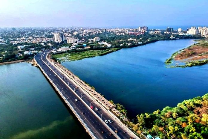
The current width of the river between Thiruneermalai and Anagaputhur measures less than 100 feet, while the ideal width, according to the river’s map, should range from 200-600 feet.
Chennai’s Water Resources Department (WRD) is planning to widen the Adyar River between Thiruneermalai and Anagaputhur at a cost of Rs 70 crore in order to prevent flooding in the city during the monsoon.
The project aims to be completed before the arrival of the North East monsoon.
Adyar river begins its journey at Adanur near Tambaram and winds its way through Mannivakkam, Varadharajapuram, Mudichur, Thiruneermalai, Anagaputhur, Kattupakkam, and Manappakkam before finally reaching the sea. The entire length of this river is 42 km.
In order to increase the width of the river from the current 100 feet to 360 feet, the WRD is awaiting the completion of land acquisition along the 2.5km stretch of the river.
The department has issued a notice to residents of Kundrathur who occupy the mostly-barren 17.7 acres of land along the river.
The tendering process for the project to strengthen embankments along the Adyar River has concluded.
The current width of the river between Thiruneermalai and Anagaputhur measures less than 100 feet, while the ideal width, according to the river’s map, should range from 200-600 feet.
This disparity makes it difficult to control floods when the river swells, as explained by a senior WRD official to The New Indian Express.
The 17.7 acres of land that needs to be acquired is mostly unoccupied, with the exception of a house near Anagaputhur Bridge.
Revenue officials are overseeing the land acquisition procedure, which began with a notice issued in August last year. A second notice was given a couple of weeks ago, and the WRD has requested that the transfer of land be completed by the first week of September.
Vulnerability of Chennai to Urban Floods
Chennai is the fourth largest metropolitan area in India, with an estimated population of 10.7 million. The population density is about 26,000 persons per square kilometre, with a high concentration of businesses and industries. It is one of India’s fastest-growing major cities, with an annual economic growth rate of six per cent.
Lack of appropriate planning has allowed urban expansion to alter the natural landscape and land use, shrinking water bodies and expanding impermeable areas.
The water retention capacity of the city’s water bodies is reduced through increased encroachment and unplanned area development, with little consideration of hydrology.
Half of the 19 major water bodies in the city have been encroached upon, severely limiting the available surface water storage potential and its ability to mitigate the impacts of extreme weather events.
The efforts taken by the Chennai Corporation are a part of the solution, but additional actions and strategies are needed to effectively tackle the complex and multi-faceted challenge of urban floods.
Continued evaluation, adaptation, and collaboration with relevant stakeholders will be crucial in enhancing flood resilience and ensuring long-term success in mitigating urban floods in Chennai.


